Park at the Wild Basin trail head and start on up. As usual, when heading to Thunder Lake, Lion Lake, or surrounding areas I would recommend taking the campsite shortcut trail to cut .7 mile off of your hike.
 The campsite trail rejoins Thunder Lake trail.
 Copeland Mountain from the trail.
 Rushing water.
 Stream crossing.
 Interesting melt patterns on a rise.
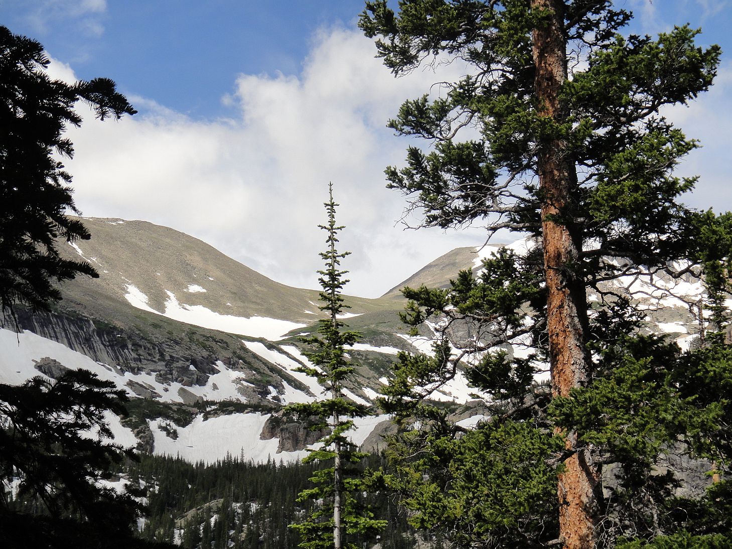 Looking up to the saddle between Mahana and Isolation Peaks.
The next sign you come to indicates the split of the trail. Stay left for Thunder Lake, take a right for Lion Lakes. Shortly after this split I hit this..


 Remember those wildflowers I mentioned? Instead I got snow. Despite all of the snow and some fallen trees, the trail was still pretty easy to follow until I got closer to the lake.
 I found this sign and was excited to be there almost. However, here is where I got lost. I kept following footprints that seemed to just end in the middle of no where, forcing me to look around and refind them. Little did I know I was right next to the lake, I just could not see it through the trees!
I finally hit on some continuous tracks that took me to the west end of the lake, and met a father and daughter from St. Louis there. I talked to them for a bit, took some photos, and headed back out...
 Tanima Peak over the lake.
 We could see what looked like footprints heading right up some of the steeper snow. In retrospect, these just may have been melt patterns, which can look deceivingly like tracks.
 Looking east from the west end of the lake.
 In panorama.
 Mt. Alice and Pilot Mountain from Thunder Lake.
 Tanima Peak keeping watch over the lake. It doesn't look nearly as steep from this perspective.
 Panorama!
 Creek cutting through the snow.
 Snow still as high as my head on the trail.
 The split of Thunder/ Lion Lake trails.
 1978 forest fire burned area.
On the way back I kept on the Thunder Lake trail to go by Ouzel Falls. This was my first visit to it this year and I was amazed by the volume of water pouring over it. The previous summer it was impressive but this was like a mini Niagara!


 Calypso Cascades cascading.
 This was the season(2011) that the St. Vrain washed out the trail just past the bridge just past the campsite trail intersection. I was amazed that the trail was just gone. As of last week (early September), repair work was still going on here, but it was dry and passable. Some people were trying to rock hop and some were crossing over some dead fall that had been thrown across. Both looked slippery and possibly dangerous, and my feet were already wet, so I just pulled up my pants and walked through the water. It was very cold, but felt great on my sore feet. Water was even running onto the bridge over the creek before falling back in. Pretty amazing!
What amazed me even more is that when I was pretty close to the trail head, I just couldn't hold it anymore and got off trail to go. I found this...
 Jesus is love.
 Aside from damaging a tree, it struck me as funny that someone took the time to carve this at a place that no one would see it. I just happened across it by chance.
I got back to the car and got ready to drive back. Another fun day hiking in the park!
Thunder Lake, 10574 feet:
6.2 miles each way, 2074 foot gain. Moderate hike.
No comments:
Post a Comment