Another week and another long day planned. After taking the last week to rest a stress injury, I was ready to get going, and get going I would- my first planned destination of the day lie 11.1 miles from the trailhead. Another, a unranked 12er, had seen only one prior ascent according to
LOJ. Looking back now, if I hadn't actually come to a stop to sit and eat a snack and had two people catch up to me, I wouldn't have seen a single person all day long. This day was truly about the remoteness and isolation one can feel in a place that millions of people visit in any given year.
I started from the trailhead shortly before 5, again making an hour or so by headlamp. I'd written about a wrong turn I took
last time around. This time I put a point on my GPS where I met Ptarmigan Creek. I'd felt it was in the wrong place on the topo. And if my GPS is correct, it is indeed not correctly marked on the map, lying nearly .2 a mile farther along the trail than indicated. Something to keep in mind.
I felt good in the cool morning air, and made great time, arriving at Lake Nokoni in about three and a half hours.
Lake Nokoni as the sun started to warm things up.
From here, I continued on the trail to Lake Nanita. This lake lies at exactly the same elevation as Lake Nokoni, but the saddle between them goes up over 11100 feet in elevation, so you'll have about 300 feet more elevation gain to get here, and of course this will have to be covered on the way back- if you head back the same way.
The saddle is quite pretty though, offering some great views of the surrounding area. This is what Ptarmigan Towers look like from below.
And what the towers look like from Lake Nanita itself.
The trail deposits you right at the lake, on a perfect little boulder. I sat and listened to the water lapping at the land. It was quite peaceful. I was tempted to jump in, as I could see deep water right in front of me, but it was again too early in the day and the air was too cold.
Looking forward.
From here, I was able to head around the north side of the lake. There are some wet and marshy areas around the outlet, but the rest is dry. Fortunately, there is also a thin but mostly easy to follow trail.
Fosters book suggests it is best to make your way up to point 11603 rather than stay down and follow the small stream up to the saddle. I did so, and was glad for that advice.
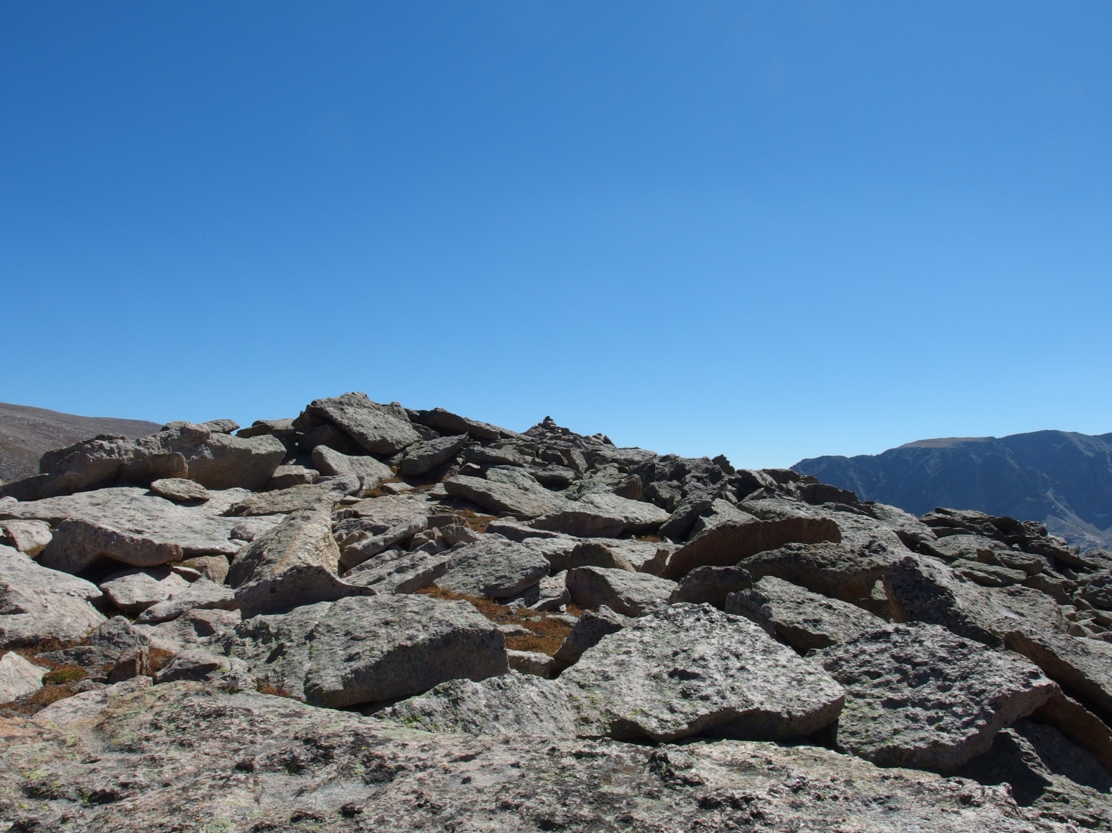
This area is choked with rock. For reference, these boulders are up to house size. It was definitely easier to stay up hill and avoid talus hopping for the time being. Though I guess when the rock gets this large, it is more weaving your way through rather than over.
Soon enough I was at the saddle to the east of Lake Nanita, which already looked as far away as a dream upon waking. The terrain was pretty nice- easy tundra (you can see it has turned brown, a sure sign winter is on the way), with some rock that was avoidable but not too bad if you wanted to or had to use it. From here I was able to look up and spy the route I planned to take from Lake Catherine to Ptarmigans Beak.
I planned to ascend up, and take the dirt and scree gully right of center here. It looked a little steeper than I'd hoped, and alot looser than I'd hoped. But it looked like it would go, and if not, I was sure I could find a way.
I now had to loose approximately one thousand feet to arrive at the lake. As I went along, I thought about all the hard to access lakes in the park. My first thought was for
Lake Powell, which lies on the west side of the park, but whose easiest access comes from a big day starting in Wild Basin. The
Fay Lakes in the Mummy Range certainly require some effort. The grouping of
Gorge Lakes stand out in my mind, though the easiest access for many of those may actually be from the west side, starting at Milner Pass. Even the lake I visited last week,
Pettingell Lake, was rather difficult to get to.
But this one might take the cake. It is 12.8 miles one way from the North Inlet trailhead, and a touch over 4000 feet of elevation gain to get there, and around 2000 feet of gain to get back. So you have to do nearly a full marathon in distance, plus 6000+ feet of gain just to visit this lake. I probably don't need to say it doesn't get much visitation.
Though the peaks above it do see some people on occasion, it appears as though you may only be able to see it from Ptarmigans Beak and perhaps from a point between
Taylor Peak and Powell Peak. I couldn't even see it until I was more than halfway down to it. I mention that because this is another named destination within RMNP that I have not been able to find a single photo of online.
Lake Catherine at the bottom of more large rock.
I stayed in the gully this time, but eventually had to exit to the forest to the west. This looked too steep to go down from above, but the travel was easier than moving on these huge boulders, again many of them house sized.
Lake Catherine, Rocky Mountain National Park.
I kind of wish that lakes had registers too. It would be neat to see how many people have been here. I would guess if this lake sees more than a single person or two a year, that would be a big traffic year for it. This year RMNP celebrated their 100th anniversary, and I would think that this lake has very likely seen less than 100 people in those years.
It was all sort of powerful and overwhelming to think about as I sat and ate a snack. This is real, raw, rugged and untamed nature and beauty.
This is what it's all about.
Ptarmigans Beak over Lake Catherine.
I'd come 12.8 miles already, and still had yet to visit a peak. I wanted to sit here all day and read a book and think, but I had to get going. The peaks were calling...
I left the lake feeling great. I was very happy and honored to drink from this lake that very few people have ever seen, let alone visited. It was about 1500 feet of gain to get to the ranked and unofficially named Ptarmigans Beak. I made my way up an animal trail that stayed to the north and west of all the rock. The going was steep, but not too crazy.
A last glimpse down at the lake.
In short order, I'd gained 500 feet or so from the lake, and stood in front of a decision. It looked like I couldn't stay down in the gully to go up to the scree/dirt ramp I'd spied earlier, so I thought I would head north and then west to go around this. From higher up, I could see that you can follow this gully and escape on some grassy ramps before you hit the rock that looks technical... if you wanted to.
The Cleaver and Isolation Peak from the other side.
But it also looked like I could stay more toward Ptarmigans Beak and make an ascent up some nice grassy ramps. This looked like it would go from below, and would cut some time and distance off, ultimately having me exit with less gain to go to get to the peak. I decided to go that way.
As I climbed up, the route made me think of a few different things. There was a steeper third class section that was reminiscent of the
short rock gully on
Oldman Mountain. The ramps themselves reminded me of
The Arrowhead. I'd say this route was second class with a few sections of third that came with some exposure. Nothing too crazy. Yet.
I was also rewarded, as the plants growing on this hillside produced the most lovely aroma, somewhat reminiscent of lavender, as I walked over them.
In the end, this route worked out perfectly, and I had only a short stroll over to the summit.
Ptarmigans Beak,
Tanima,
The Cleaver,
Isolation Peak.
Fleur de Lis and Mount Craig.
My last vision of Lake Catherine and its beauty. For now.
The summit register was another one of the all time greats, again a whos who of Colorado Mountaineering legends. I was honored to leave my name aside the likes of Kirk and Kirk, Dale, Foster, Knapp, Kalet, Garratt, Offerman, Nolan, Martin, and Gergen to name a few. The list of incredibly inspiring people I've never met goes on and on and grows longer and longer with every peak.
I turned my attention toward Andrews Peak. There is a photo in Fosters book, as well as one
here that shows a superfluously huge cairn built on the summit. I couldn't see it from Ptarmigans Beak, and thus thought this one might be a little tricky. Not in the sense of technicality, but in the sense of a false summit or two.
I made my way down and then started up. This was the first time during the day that I really seemed to feel it, and I guess not without cause. It was relatively steep going, and at this point I already had 14 miles and nearly 6000 feet of gain under my belt. I was ahead of my time estimates, so I simply took my time and paused for a break when needed.
I was able to get a great view of the grassy ramps route I took up, almost directly center, below the high point. It looked pretty wicked and steep from here. I passed by my original plan and looked down over the dirt and rock. It looked worse.
I arrived at the summit to find this fairly short cairn. The tall one as pictured elsewhere must have been knocked over by weather or a person.
The prevalent ethic in the outdoors these days is leave no trace, and one can hardly say a four foot high cairn isn't leaving a trace. But in that sense, any cairn is a trace. A summit register is a trace. So who knows. Something that big did seem rather silly to me though!
I could look to the northwest and see the next goal of the day. I knew the terrain between here and there was rather flat, and felt I would be able to make pretty good time here. I was hoping it would take me no more than an hour to cover this distance.
Lake Nanita, far, far away.
Getting close to Ptarmigan Mountain, with Ptarmigan Towers on the right.
A closer look at the Ptarmigan Towers high point at 12220 feet.
I made it to the flat summit of Ptarmigan Mountain. There was a small register here, a baby food jar placed by the Kirks earlier in the year. Unfortunately, it had already been well wetted. I opened it up and turned it toward the wind to dry it out a bit while I explored the possible route to Ptarmigan Towers.
As I made my way toward this point, I noticed a small cairn built. I went to it and looked down. It didn't look good. I continued along to find the point where the ridge would connect with the land I was standing on. I made my way down a little bit. It looked like a drop of maybe ten feet at most to get down from where I was, but there were absolutely no holds and I wasn't about to drop off that distance from where I was.
I went back to the small cairn. Maybe I needed to look a little more carefully. I looked down over the edge and noted a weakness in the rock. Just a thin crack, no more than a foot wide. But it looked like it had some holds. I went down it, making an awkward big step down move. This was surely 4th class, not the third I'd seen reported for this point.
I stopped when things below me thinned out and the holds shrank. Ok. This would not do. I felt very exposed and unsafe. I'd only come down maybe ten or fifteen feet, and made my way back up.
What to do? I could leave this point for the future, but I'd have to come all the way back here just for it. I still had plenty of daylight left, perhaps I could find another way. Even if it took me an hour to get there and back, that was less than coming all the way back here.
There was a steep gully running down from this point. Maybe I could get into that to get up to it, but how could I get down there? I walked back toward the summit, looking at the ground below me. There was a gully that started just past the summit of Ptarmigan Mountain. It looked too steep, but I could see a small flat area east and below the summit. It would be easy to get to there, and then access the gully.
Going down was very loose over dirt, rock, and scree. Coming back up was a bit better on grass with some rock and dirt. Twice I put my hands down in thistles. Yeow!
I made it to the bottom of the gully, and worked my way up until things were flat. I decided to stay on the ridge line of the saddle, if that description makes sense. This wasn't the best idea and had me make a few exposed fourth class moves. Then I was finally at the base of the pinnacle.
Looking back to Ptarmigan Mountain. See that snowfield to the left?
This twisted looking piece of rock is the last small spire before you start the third class ascent to Ptarmigan Towers.
The rest of the route was some slabby third class, followed by more stable third to the top. Just a few rocks marked the small summit.
Looking back down the way I'd come up. Pretty darn steep!
The Ptarmigan Towers high point as seen from the mainland.
Longs,
McHenrys,
Chiefs Head in the background.
The gully down from Ptarmigan Mountain definitely felt easier going back up. Perhaps my mind was just a little freaked out by that thin crack I'd tried to descend earlier. All in, it was some very steep and loose third class to get to this point in this method. While Listsofjohn isn't the be all and end all of peaks, this point only had one previous ascent listed there, by none other than Gerry Roach. In the end, it did take me nearly an hour and a half from the time I hit Ptarmigan Mountain to get to Ptarmigan Towers and back. Alot of time to go a very short distance, but this probably demonstrates the extreme difficulty of the terrain.
I had finished my water on top of Ptarmigan Towers, and now hacked away at the snowfield pictured above. I ate some on the spot, and put some in my bladder to take with me. I didn't take alot though. I thought I'd be able to find some water fairly soon.
From here, I headed almost directly south to my next goal of the day, Mount Cairns. This is barely a mountain, but rather one small closed contour loop on the topo overlooking the East Inlet drainage. I am sure the steep cliff faces that border it on the south side look impressive from below, but from my vantage point, it barely looked like anything at all. Of note, there is a small rock outcrop in the area. This is not the summit!
No cairn or register here. It didn't look like anything at all, and I had to use my GPS to verify I was in the right place. I was.
While I still had the snow with me, it was now almost two hours since I'd drank the last of my water. I spied a small pond, but the water looked disgusting. Nonetheless, I was feeling thirsty, and now realized I should have taken more time to cut some snow out and take it with me. I would just have to deal with it.
I moved northwest from here, trying to contour around point 11588 without gaining or loosing any elevation. When I hit the ridge, I would descend to the saddle between this point and Mount Enentah, and then climb this peak. The bushwhacking was (fortunately) easy to moderate, with some dead fall and brush to negotiate. Twice I passed small seeps, but again the water looked tepid and foul. I ate the last of the snow shortly before I hit the summit of Mount Enentah.
Another unspectacular treed in summit. But that's okay. An interesting thing is that the Alva B Adams water diversion tunnel passes directly under this peak. It is the only peak in the whole of the park to have this distinction.
Without water, I found it difficult to eat anything, so I picked my most liquidy snacks and had a bite. From here I could either head northeast, hit the creek, and follow it down to the trail, or head southwest and descend the flatter western flank of this peak until I felt I could ascend the steep north face down to the trail. I decided to head southwest.
I stayed on the ridge line until I got to around 9750 feet, and then turned north and descended directly to Summerland Park. It was quite steep, but again the bushwhacking wasn't too bad. Fortunately, I was only stopped once by a small cliff that I had to pick a way around. I could see from below that I was lucky, as I ended up coming down within spitting distance of a rock face that would've been too steep to descend.
I made my way through the thick and tall grass of the meadow, and finally hit some good water. The tablets I use are one per two liters, and you have to wait half an hour. I decided to go with two tablets for two liters and wait twenty minutes. At this point it was about an hour and a half since I'd eaten the last of the snow, and over four hours since I finished off the water. I was a little thirsty!
Moving through the grass felt like snowshoeing, and several times I found clearings that had been tamped down by elk or moose. Fortunately, I ran into neither, and after what felt like a long time, hit the trail. It was the second time this day that I felt I should bend and kiss the earth.
It had been twenty minutes, and I drank greedily and ate some food. I decided to hike as quickly as I could, and again, just beat the sunset to the car. Only a two hour drive in darkness ahead of me now!
Some elk were spotted as I drove back through the park. I made good time for the most part, but got stuck fifth in line behind someone coming down 36 between Estes and Lyons. Whether you drive this road frequently or not, please be aware. When you are slowing down to 25 mph for every curve and there is traffic stacked up behind you and some of those people start to illegally pass you, please use the slow vehicle pull outs!
I got back home, ate some food, took a shower, and collapsed into bed. Rest!
What a day this was, visiting pristine and unspoiled alpine lakes that rarely see a soul and peaks that see a few people a year, if that. Not much to my surprise, the west side of RMNP is proving to be just as beautiful and inspiring as the east side. At the same time, it definitely feels more vast and open. Of course, this means longer days, more mileage, more elevation gain. I am all too happy to rise to the challenge!
Link to hike map on
Caltopo.
North Inlet Basin- Earth (distances as part of the hike):
Lake Nanita, 10780 feet: 11.1 miles, 2280 foot gain. Strenuous-.
Lake Catherine, 10600 feet: 12.8 miles, 1800 foot gain. Strenuous+.
Ptarmigans Beak, 12241 feet: 14.1 miles, 3841 foot gain. Third class (my method). Strenuous.
Andrews Peak, 12565 feet: 15 miles, 4165 foot gain. Second class. Strenuous.
Ptarmigan Mountain, 12324 feet: 16.7 miles, 3824 foot gain. Second class. Strenuous.
Ptarmigan Towers, 12220 feet: 16.9 miles, 3720 foot gain. Third class+. Strenuous+.
Mount Cairns, 10880 feet: 19 miles, 2480 foot gain. Second class. Strenuous-.
Mount Enentah, 10781 feet: 20.7 miles, 2281 foot gain. Second class. Strenuous-.
You'll also go by several destinations such as Cascade Falls and Lake Nokoni that I have covered
here.
As a whole, this hike covered approximately 23.6 miles with just over 8000 feet of elevation gain in up to third class terrain. Strenuous+.


