Showing posts with label mcgregor mountain. Show all posts

Wednesday, December 10, 2014

Lumpy Ridge Loop and Sheep Mountain Rock.

It was a dark and stormy night...
Actually, the night was quite peaceful, and despite some exceptionally high winds expected at altitude, the forecast lower down was looking good.
The early wake up saw me once again be the first person at the trail head, and the wind sculpted clouds sitting over the Front Range provided quite a show as the sun rose.
So, yes it was worth getting up early. 
A few minutes of this natural light show was all that there was to see.  Note: other than being resized, these photos have had no processing.  This is what the neon morning actually looked like.
Clouds rimmed with neon pink behind trees in the parking.
In a short time, I was on my way to Gem Lake.  This is a great moderate hike in the park, perfect for families.  I gained elevation on the trail, and got to the lake in about an hour.
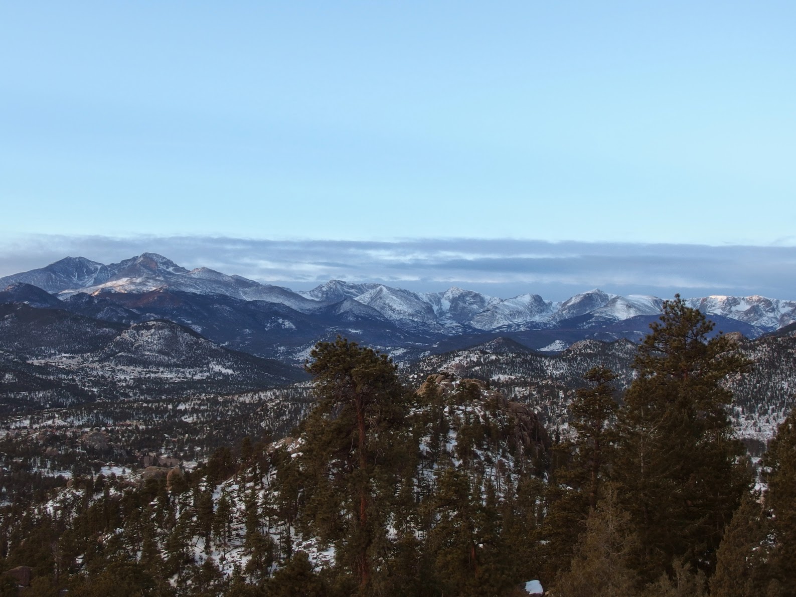
Views to the south. 
And south west.
While at the lake, I decided to try to ascend "East Gem Peak" or "East Gemstone", an unranked and unofficially named destination in the park.  This is the high point that lies directly behind Gem Lake.  There are probably multiple ways up, but I decided to take what looked like the easiest method- gain the top of the bench behind Gem Lake and walk over.  This involves some 2nd-3rd class scrambling on slabs, and all was going smoothly until I came to a deep chasm near the summit. 
I spied this spray paint defacement on a rock along the way.
I looked for a way around this obstacle, loosing elevation and heading north east.  Eventually I decided I was spending too much time, and with the snow and ice on the slabby rock in the area, it was not a good idea to continue.  This will have to wait for a time when everything is dry.  It looks like it will be a fun scramble, likely in 4th to 5th class to get up the chasm.
Onward, I started to loose some elevation as I dropped toward Cow Creek.  The next goal of the day became visible, the aptly named Sheep Mountain Rock, here seen just left of center.  Of course, I'd neglected to visit this when I was here last time, so a return trip was in order.
Sheep Mountain Rock on Sheep Mountain.
I crossed the creek and basically followed the mudslide area up until it started turning east or right.  Then I simply picked a way up the gully on the left.  The bushwhacking isn't too bad, but it is rather steep, gaining almost 1600 feet in around 8/10ths of a mile. 
Along the way I spied a plant that looked familiar- I'd seen a young example of this species earlier in the year.  Pterospora, aka Pine Drops.  You can read some more about them here.
Closer up to see some of the structure. 
And closer still...
I finally got to the top of the gully and headed west.  After spending some time looking around and taking GPS readings, I determined that this was the high point.
With my backpack for scale.  There were alot of little random highpoints, but this looked to be the highest.  Of note, the LOJ highpoint is slightly south of here, but actually lower than this.
I ate a snack and headed back on down.
If you happen to want to see Pterospora, this is apparently a good place to find them, as I saw multiple examples on the way down.
I hadn't really explored the ability of my new camera to function in close up mode, but with manual focus, you can get the lens about 1 cm away from the subject, which is pretty neat.  You can actually see the tiny seeds in the pods here.  For reference, the pods are about the size of you pinky fingernail.
Pretty cool!
The damage incurred in the flood is no less amazing a year later. 
I made it back to the trail and promptly lost a layer of clothing.  It was getting quite warm!
Though I have hiked the loop in segments, I've never done it as a whole until now.  Some good views of Sheep Mountain Rock kept the spirits high.
I crossed the creek and found Rabbit Ears, a rock feature which gave name to the campsite location here.  To see the feature, find the actual camping spaces and move to the back of them.  Turn around to face south and there you are!
Back on the trail I spied Dark Mountain in the distance.  This provided a fun and memorable hike.
The trail remains rather flat with little elevation gain until you pass the last of the campsites.  Then it is on!
The highpoint is reached, and you start the descent back to Lumpy Ridge.  It was pretty fun to jog downhill in the snow, observing the various high points of the ridge.
Lumpy Ridge in all its glory!
Farther down I stopped and looked back to see this high wind blown cloud stretching between Lumpy Ridge and McGregor Mountain.  Very pretty!
Twin Owls towering over the area.
I ended up continuing on the trail toward Gem Lake rather than going back to the parking to take some time to explore the boulders in the area.  I'd climbed here years ago and it brought back some memories.
I suppose this wasn't the most prestigious hike, with the highest elevation being slightly over 9600 feet, but with the up and down and up and down and up and down, a decent amount of elevation gain was had anyway.  The loop itself is a fun challenge and circles a very interesting feature in the park, with many of the higher peaks visible in the distance from various points.  Sheep Mountain and its rock are rarely visited and can offer a sense of solitude in a place that is relatively close to McGraw Ranch/Cow Creek Th.  This trailhead is busy enough in the summer I wouldn't expect to get a parking place if you don't arrive early.
Lumpy Loop and Sheep Mountain Rock via Lumpy Ridge Th:
Sheep Mountain Rock, 9660 feet: 4.7 miles one way, 1808 foot gain*.  Third class.  Strenuous-.
Lumpy Ridge Loop: 10.7 miles round trip, 1275 foot gain*.  Moderate+.
As a whole this hike covered approximately 12.3 miles with 4666 feet of gain.  Strenuous-.
*= significant ups and downs along the way mean you'll actually gain a whole lot more than this.

Thursday, May 30, 2013

Dark Mountain and Bridal Veil Falls via Cow Creek TH.

It may be summer at the lower altitudes, but the weather this week was a firm reminder the spring still rules higher elevations. 
We wanted to go higher, had again thought about some of the peaks easily accessible from the divide, but things were not looking good up there.  But the forecast looked slightly better for this minor peak in Mummy Range.  
It started to rain just as we were getting into Estes Park, and continued as we drove past the Stanley to turn right on MacGregor Road.  Continue on this as it becomes Devils Gulch Road, and then take a left on McGraw Ranch Rd.  This dirt road will take you to the trail head- parking is on the left side of the road, so turn around and find a place.
At the parking in the rain, in full anticipation of a miserable day, in hopes that it would get better.
Even with rain gear, it was hard to get out of the car and get going, knowing this might be the last time I'd be warm for the next five or more hours.
Dark Mountain as seen from pretty early on.
Things did get better, and quite soon.  The rain slowed, and then stopped for the most part within forty five minutes or so.
The views from the Cow Creek trail are very pretty.  It cuts through a nice section of ranch land and open forest, before gaining some elevation to more heavily wooded areas.
Dried off for now.
We took the trail up to the saddle between Dark Mountain and Lumpy Ridge, and then turned north and started uphill.  We could see some cliff faces through the trees, and of course wanted to avoid those.
And then it started snowing.
At least it looked very pretty.
As we walked up, Dan remarked that it could be any month of the year, and from the picture above, I probably wouldn't have guessed May 29!
We arrived at a plateau, and could it be?  But no, there were still a few hundred feet to go.  This was probably the most difficult part of the climb, mostly due to the increasing amount of rock which was now quite wet/icy and slippery.  As we gained elevation we could hear the wind roaring around us as well.
We topped out onto a ridge, at a point which proved to not be the summit.  Though now pretty cold, the views were quite exceptional.
Mummy Mountain flirts with some low clouds.
Summits visible and hidden.
 Bighorn Mountain.
McGregor Mountain.
We very carefully made our way west to what looked like the true high point.  In addition to the light coating of fresh snow, there was a little bit of snow still hanging around from the winter.  This point did turn out to be the true summit, though we didn't spend much time there due to the wind and snow.  I remarked to Dan that I didn't expect to have completely numb fingers when hiking at the end of May (this despite wearing winter gloves).
We made a good decision on a destination for the day.  Most of the rest of the park looked completely socked in.
Cold at 10859 feet.
We decided to head back down and get out of the wind before having a snack.  When we stopped, we were in full sun and the earlier snow was melting quite quickly.   Since it melted, we lost our path up and were now navigating by sight for the most part.  We eventually made it back to the trail, maybe fifty feet east of where we had left if to head up.  Not bad navigating!
Since things had now gotten alot nicer, I managed to convince Dan to take a shortcut to Bridal Veil Falls on the way back.
 On the way...
Interesting looking rock cut and sculpted by ages of water.
This was my first time at this waterfall, and it was quite spectacular.  I imagine with all the late season snow, this will be a good waterfall year.
Getting back to the Cow Creek Trail.  Funny, starting in full rain gear plus some winter stuff to end in shorts and t-shirt.
I am glad the weather cleared up.  This is really a pretty place to hike though.
In stark contrast to the earlier photo, Dark Mountain in the sunshine filled afternoon.  
It was nice all the way back to the car, so much so it was hard to believe it had been raining earlier, or snowing, or that it was anything other than a beautiful early summer day.
It took us just over six hours to cover all this ground, which is entirely not bad.  We both felt Dark Mountain was a bit easier than anticipated, that being we thought we'd have more of a bushwhack to deal with.  In reality some downed trees were about the biggest obstacle of the day.  Plus we were the only people to be on the summit since February, at least as far as the register was concerned.  
This was a fun day, and again an illustration of the kind of destinations that I like in the park.  Yes, in the middle of summer you could head to Longs or to Bear Lake TH and run into masses of people.  Or you could go here and have things all to yourself.  
Dark Mountain and Bridal Veil Falls via Cow Creek TH:
Dark Mountain: 4.5 miles one way, 3039 foot gain (7820-10859).  Moderate+.  Some second class near the top.
Bridal Veil Falls: 3.1 miles one way, 1060 foot gain (7829-8880).  Moderate-.

Tuesday, January 8, 2013

McGregor Mountain via Lumpy Ridge TH.

Several weeks ago when the temperatures were still unseasonably warm, Dan and I met up early one morning to try for one or more of the peaks in the Lumpy Ridge area.  This is somewhere in RMNP I hadn't really hiked at before, save for some wandering around with crashpads looking for boulder problems with Katie. 
The hike starts with a short gain, followed by a relatively flat few miles.  I know there are a ton of people who do the loop around Lumpy Ridge, which around ten miles. 
The scenery here is pretty impressive.  It is a working ranch so there are the occasional cow pies to avoid, but looking at photos like the two above can transport us back in time.  This is probably what most of Colorados front range looked like 150+ years ago.
Cattle grazing.
A deer sighting.
We stayed on the trail for 3 miles or so- if you look at a map, we left it very shortly after the trail takes a definite turn to go almost directly north to meet the Black Canyon trail, almost directly east of the high point of MacGregor.
Black Canyon Creek in all its glory.
We hopped the creek and started up.  The going was, of course, tough at times.  There were lots of trees down as seen below.
The Needles.
Lumpy Ridge and The Needles.
From the trail we could see places where there were no trees, just bare rock.  Thinking this would be easier to head up, we found some and stayed on it.  Well, it's a little steep.
Dan and F_\mathrm{f} \leq \mu F_\mathrm{n}.
Yeah, its a little steep.  Again we talked about the question of grade.  We decided this could be anywhere from third to low fifth class.
As you gain elevation, ever better views of Lumpy Ridge await.
Awesome looking Krumholtz near the summit.
We topped out the last slab and finally (it felt) reached a plateau.  The summit lie shortly after. 
Dan at the summit cairn.  If you happen to make it up here in 2013, take a new small notebook with you.  The one here was completely full. 
Looking down to the Fern Lake fire. 
Beauty.
Meeker and Longs. 
Looking into Mummy Range.  We've talked about doing Mummy Madness (though I prefer the name Mummy Kill:) next summer.
We decided to see if we could find a descent down the north side of the peak to try to make our way to the ominously named Dark Mountain.   
Another fatty Krumholtz near the summit.
We looked and circled back east around the north face, but after a rather technical climb up, decided we didn't want to try to find a way down the cliffs.  Dark Mountain another day then.
Longs and Meeker almost completely free of snow.
We ended up arriving back at the summit and descending southeast from here.  We ended up in the drainage between the mountain and the high point to its SE.  We followed this down to Black Canyon Creek.
Easy going at this moment, but we did face some slabs on the way down as well.
Black Canyon Creek.
And down, where it eventually meets with Fall River and ends up in Lake Estes. 
Cattle have moved, but not much.
A beautiful day.
McGregor Mountain as seen from the Black Canyon Trail.  It looks improbable for us to have climbed!
This was a pretty fun hike, not taking all that long, but still getting in a rather good off trail workout- we both felt we have done easier 12ers and 13ers.  I feel like my technical climbing experience helped alot since I was basically able to shut my mind off and do it, but it's not something absolutely necessary.
I am really looking forward to spending alot of time in this sector of the park next year.  Until then!
McGregor Mountain via Lumpy Ridge TH:
4.25ish miles one way, 2634 foot gain.  Third to fifth class.  Strenuous-.